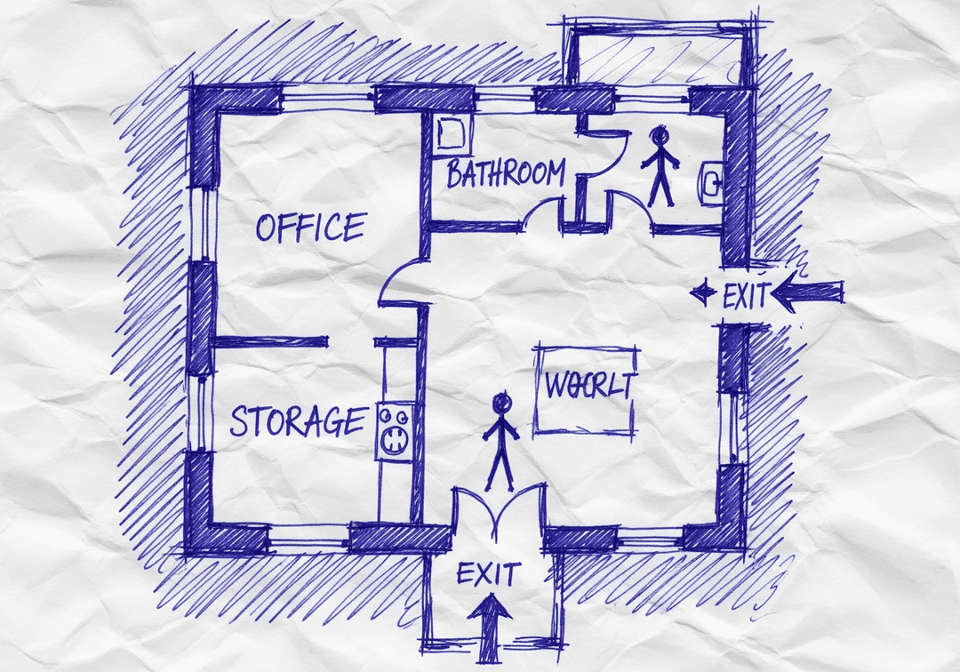
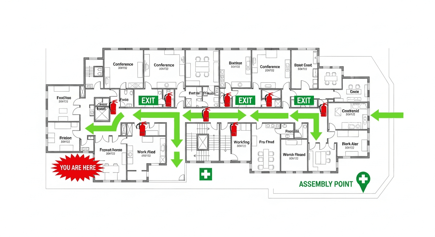
Upload your blueprint, hand-drawn sketch, or photo and get a vectorized, print-ready PDF evacuation map in 30 seconds. Our AI analyzes your floor plan, identifies exits, calculates optimal routes, and creates professional OSHA-aligned maps instantly.
Keep the building familiar. Make the safety story legible.
OSHAMap turns the layout you already have into an editable OSHA-aligned draft—so a safety professional can focus on verification, not redrawing.
01 / SOURCE
Start with what you have.
A floor-plan PDF, phone photo, or hand sketch gives the draft a place to begin.
Upload PDF, image, or sketchEditable safety elementsExport after review
YOUR SOURCE
PDF · photo · sketch
SAFETY LAYER→
ILLUSTRATIVE EDITABLE DRAFT
EXITEXIT●●YOU ARE HEREASSEMBLY
Review before posting
Built for reviewConfirm site-specific routes and equipment.
Designed to editMove, resize, and adjust visual safety elements.
Ready to shareExport the reviewed draft as PDF, PNG, or SVG.
AI Creates the Draft. Your Safety Team Makes It Site-Ready.
Faster first drafts. Human-reviewed decisions. Safer U.S. workplaces.
INSIDE THE EDITING EXPERIENCE
AI creates the first draft.Your team stays in control.
The automation gets you to a strong starting point. The editor keeps your team in control of site-specific details.
WALKTHROUGHEvacuation map · editable draft
SelectRoutesExit signsEquipment
EDITABLE DRAFT
REVIEW CHECKVerify exit routeConfirm this path reflects the current facility.READY FOR REVIEW
EXPORT REVIEWED DRAFT
PDFPNGSVG
01 / 04 · Open draft
Your generated draft opens in the editor.
Start from the OSHA-aligned map draft and keep the building layout in view while you review each safety element.
OSHAMap creates an OSHA-aligned draft for review. Your safety team or AHJ should verify the final map before posting.
Why Safety Managers Choose Our AI Evacuation Map Generator
Do I need design skills to create an evacuation map?
No design skills are required. Our AI understands hand-drawn floor plans, smartphone photos, scanned blueprints, and PDF documents. Simply upload any representation of your facility layout and receive a professional-grade emergency evacuation map instantly.
Are the generated maps OSHA-aligned?
OSHAMap is designed to help users organize key evacuation-planning information commonly associated with OSHA 29 CFR 1910.38 — clearly marked exit routes, fire extinguisher locations within 75-foot travel distance, assembly points, YOU ARE HERE markers, and accessibility accommodations per ADA guidelines. Each draft must be reviewed and verified for the actual workplace by the employer, safety officer, or AHJ before posting.
Can I update my evacuation map after renovations?
Yes. If you renovate your office or add an emergency exit, re-upload the updated floor plan and create a new draft for review. Free accounts include up to 5 regenerations per upload; verify each revision against the workplace before posting.
What types of buildings can use this evacuation map generator?
Our generator works for any building type including warehouses, manufacturing plants, healthcare facilities, schools, retail stores, and office buildings. The AI adapts to any facility size and layout, generating appropriate exit routes, fire safety equipment placement, and assembly point locations.
AI-Powered Features for Professional Results
Our advanced AI handles every aspect of evacuation map creation, from floor plan analysis to compliance verification
📤
Upload Any Format
Our AI accepts PDF blueprints, CAD files (DWG, DXF), scanned documents, photos of hand-drawn sketches, and even napkin drawings. No special software required.
✓PDF architectural drawings
✓AutoCAD DWG and DXF files
✓Scanned paper blueprints
✓Hand-drawn floor plan photos
✓PNG, JPG, and TIFF images
🤖
AI-Powered Analysis
Advanced computer vision identifies walls, doors, windows, stairways, and existing safety equipment. The AI understands spatial relationships and building codes.
✓Automatic wall detection
✓Door and window identification
✓Stairway and elevator recognition
✓Existing fire extinguisher placement
✓Room dimension extraction
🚪
Smart Exit Routing
AI calculates optimal evacuation routes based on OSHA 29 CFR 1910.36 requirements. Routes are optimized for shortest path while maintaining proper egress width.
✓Primary and secondary exit routes
✓OSHA-aligned path widths
✓Maximum travel distance compliance
✓Dead-end corridor identification
✓Assembly point designation
🔥
Safety Equipment Placement
Automatically positions fire extinguishers, pull stations, AED locations, and first aid stations according to NFPA codes and OSHA requirements.
✓Fire extinguisher positioning (NFPA 10)
✓Pull station locations
✓AED placement optimization
✓First aid station markers
✓Emergency lighting indicators
📄
Print-Ready Vector PDF
Output is a high-resolution vector PDF that scales perfectly for any print size. From 8.5x11 desk copies to large wall-mounted posters.
✓Vector graphics (infinite scaling)
✓CMYK color-optimized
✓Standard paper sizes supported
✓Large format poster ready
✓High-contrast emergency colors
✅
OSHA Compliance Guaranteed
Every map meets OSHA 29 CFR 1910.38 Emergency Action Plan requirements and 29 CFR 1910.36 egress standards. State-specific requirements are automatically applied.
✓Federal OSHA compliance
✓State-specific requirements
✓NFPA Life Safety Code aligned
✓ADA accessibility routes
✓Local fire marshal standards
Ready to Create Your Map?
Generate your OSHA-aligned evacuation map in 30 seconds