✅ Compliance StandardsEssential Guide

School Evacuation Map Requirements: K-12 & Higher Education

Comprehensive guide to evacuation mapping for schools, from elementary classrooms to university campuses.

MonthlyDrills Required
LocalPosting Rules
State + FederalRequirements

Prepare classroom or campus drafts for district and AHJ review

🛡️OSHA-Aligned
⭐7,500+ Maps Created
✅100% Satisfaction
🔍
You searched:"School evacuation map requirements"

📄School-Specific Requirements

School evacuation duties vary by state education rules, adopted fire codes, occupancy, and district policy. Drill frequency and classroom-diagram requirements are jurisdiction-specific. Administrators should coordinate with the district and AHJ to confirm required drills, diagrams, posting locations, route content, and accessibility procedures.

📋K-12 School Requirements

  • 📋Monthly fire drills during school year (most states)
  • 📋Classroom or common-area diagrams where required by state, district, or adopted-code rules
  • 📋Teachers must review routes with students at start of year
  • 📋Designated assembly areas for each wing/grade level
  • 📋Accommodation procedures for students with disabilities
  • 📋Lockdown procedures posted alongside evacuation maps
  • 📋Parent reunification procedures for elementary schools
  • 📋Visitor evacuation procedures for front office areas

📋College & University Requirements

  • 📋Classroom and lecture-hall diagrams where required by campus policy or the AHJ
  • 📋Dormitory-specific evacuation requirements (per floor)
  • 📋Lab buildings may have chemical-specific evacuation protocols
  • 📋Large venue evacuation (stadiums, auditoriums)
  • 📋Coordination with campus police/security
  • 📋Multi-building campus-wide emergency communication
  • 📋Semester drills in residential buildings

✓School-Specific Map Elements

  • ✓Primary route to outdoor assembly area
  • ✓Secondary route if primary is blocked
  • ✓Class/Room number clearly displayed
  • ✓Teacher rally point for headcount
  • ✓Wheelchair-accessible route (if different)
  • ✓Shelter-in-place location for severe weather
  • ✓Nurse/Health office location for medical emergencies
  • ✓Fire extinguisher and pull station locations

📊School Emergency Statistics

🔔
10Drills/Year

Most states require 10 fire drills during the school year

✅
98%Schools Compliant

Of schools report conducting required fire drills

📋
62%Map Accuracy

Of school evacuation maps contain outdated information

⏱️
3 minTarget Time

Schools should achieve full evacuation in under 3 minutes

👨‍💼
Expert Tip

Expert Advice for School Safety

Dr. Katherine BarnesSchool Safety Coordinator, National Association of Secondary School Principals

The biggest challenge in school evacuation isn't the drill itself - it's keeping maps current when classroom assignments change every year. I recommend building a map update into your back-to-school checklist. Every August, walk each classroom with your new floor plan, verify routes, and regenerate maps with correct room numbers. AI tools make this manageable even for large campuses. Also, involve students in the process - when kids understand WHY evacuation routes exist, they take drills more seriously.

📄School Map Review Workflow

Inventory current rooms, additions, portable classrooms, exits, and district emergency procedures. Prepare location-specific drafts only where diagrams are required or useful, then verify routes on site. Before posting, have the district safety lead and AHJ confirm the applicable rules, content, accessibility information, orientation, and locations. A generated draft does not guarantee an audit or inspection result.

❓

Frequently Asked Questions

Most states require monthly fire drills during the school year (typically 9-10 drills). Some states require additional tornado, earthquake, or lockdown drills. Check your state education department requirements.

There is no single federal rule requiring a diagram in every classroom. State education rules, adopted fire codes, district policy, or the AHJ may require location-specific diagrams. Confirm which classrooms and common spaces are covered before posting.

Yes. Schools typically have stricter requirements including more frequent drills, classroom-specific maps, and special procedures for accounting for all students. State education departments often have requirements beyond OSHA and local fire codes.

The answer depends on locally adopted NFPA 101 provisions, state education and fire-marshal rules, local codes, district policy, and OSHA standards applicable to employees. Confirm the adopted editions, occupancy classification, local amendments, and diagram duties with the AHJ.

Mark accessible exits, areas of refuge, and elevators (labeled "not for fire use"), and pair the map with a plan that assigns staff to assist students with disabilities. The ADA and NFPA 101 require an accessible means of egress for every occupant, so each classroom diagram should show at least one accessible route to the assembly area.

Typically the school administration or the district safety/facilities coordinator, working with the local fire marshal or authority having jurisdiction. Review maps before each school year and after any renovation, building addition, or room-renumbering, because outdated diagrams — wrong room numbers or missing portable classrooms — are one of the most common findings in state safety audits.

📚

Generate Your OSHA-Aligned Evacuation Map

Upload your floor plan and get a professional, compliant evacuation map in minutes.

📊 5 Free Maps Left

Create Your Evacuation Map

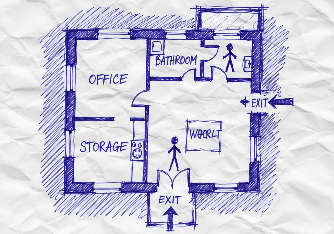
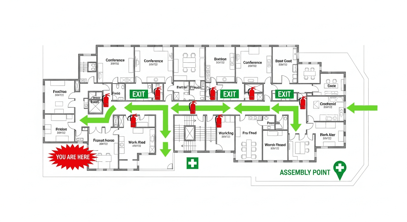
See the safety plan from every angleWatch a sketch become a polished map, then step inside.Watch demo Need to start from a rough layout?Sketch rooms and exits, then turn it into a clear safety map.Draw your map
✏️
High ContrastUse dark ink on white paper. Bold lines help our AI detect walls accurately
📐
Top-Down AnglePhotograph from directly above — tilted angles distort the geometry
🏷️
Label RoomsWrite "Exit", "Storage", "Breakroom" etc. — our AI reads your labels for compliance
🔍
Full Floor PlanCapture the entire layout including all walls, doors, and exits — no cropping
🚪
Mark ExitsCircle or label exit doors with a red dot or "EXIT" text for best detection
💡
Good LightingAvoid shadows and glare — even lighting produces the sharpest results
📁

Drag & drop your floor plan here

or

PNG, JPG, HEIC, TIFF, BMP, SVG, AVIF, WebP, PDF, DOC, DOCX, PPT, PPTX, XLS, XLSX, ODT, ODP, ODS, DXF, DWG - Hand-drawn sketches work too!

or

No floor plan handy? Try the included floor plan with real AI generation — no upload needed. This may take a minute or longer.

Edit your map for free.
Move, resize, and recolor every exit sign, route, and icon.
Create a free account to save and download in HD. No credit card required.
FREE
🔒Your files are private: never shared, stored temporarily, deleted automatically.

Compliance Options

🔥 NEW✨

Customize Your Map

Add special requests for your safety map - tell our AI exactly what you need!

  • 🎯Add specific details like "Mark fire extinguisher near kitchen"
  • 📍Request specific zones: "Highlight assembly point in parking lot"
  • 🏥Add safety equipment: "Include AED location near reception"
0/2000

Quick Add:

Automatic (recommended)

Redraw the architecture from your floor plan first, then add editable safety markings. The original upload remains a reference, not the map background.

Frequently Asked Questions

Is this evacuation map generator really free?

Yes — you can generate your first OSHA-aligned evacuation map draft completely free. Just upload a floor plan and our AI drafts a professional map in about 30 seconds. No credit card required.

Are the generated maps aligned with OSHA?

Our AI drafts maps that follow OSHA 29 CFR 1910.36–37 and NFPA 101 Life Safety Code standards. Every map includes clearly marked exits, fire extinguisher locations, assembly points, and directional evacuation arrows. Supervisor review is required before posting to your facility.

What file formats can I upload?

We accept PNG, JPG, GIF, WebP, BMP, TIFF, AVIF, HEIC, SVG, PDF, DOC/DOCX, PPT/PPTX, XLS/XLSX, ODT, ODP, ODS, DXF, and DWG floor plans. Office and CAD files are converted securely before processing; PDF uploads let you choose the source page.

How long does map generation take?

Most maps are generated in 20–40 seconds. Complex multi-floor plans may take slightly longer. You see the preview instantly — create a free account (no credit card) to download the file.

Can I edit the map after generation?

Yes — every generated map opens in a free drag-and-drop editor where you can move, resize, and recolor exit signs, routes, and equipment icons. Enterprise features like multi-floor support and branded maps are available on paid plans.

Is my floor plan data secure?

Yes. All uploads are encrypted in transit (TLS 1.3) and processed in secure cloud environments. We do not share your floor plans with third parties.